Built on Real Data
Reliable data from a nationwide physical device network, enhanced by broad mobile coverage. No opaque or synthetic data source.
Power Policy and Strategy With Verified Real-World Activity Data
Support public decisions and advisory engagements with objective, real-world movement data that reflects how people actually use cities, infrastructure, and public spaces.
Use high-fidelity location and mobility data to inform planning, evaluate policy outcomes, and deliver defensible, data-backed recommendations to public and institutional clients.
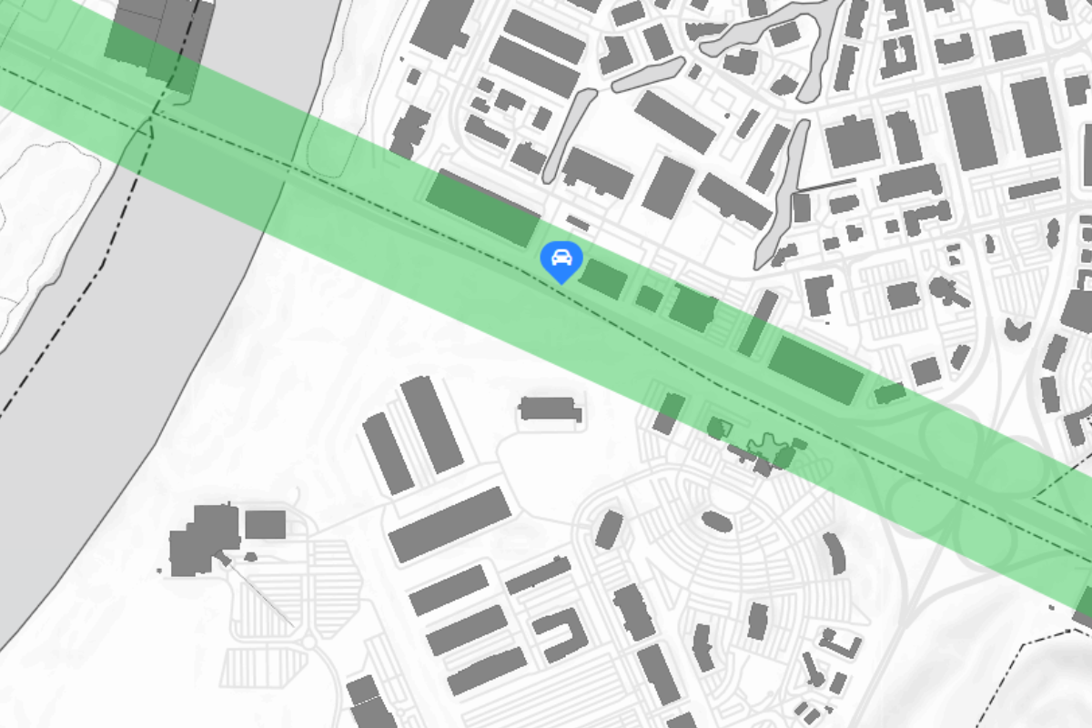
Analyze traffic flow, visitation patterns, and area activity to inform development planning, zoning decisions, public space design, and infrastructure investment.
Quantify how policies, public investments, or regulatory changes affect real-world behavior, enabling objective evaluation and continuous improvement.
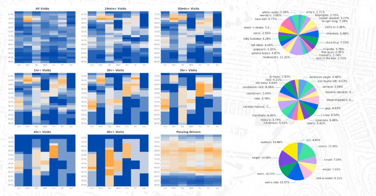
Provide clients with empirical evidence to support strategic recommendations, scenario analysis, and long-term planning initiatives
Compare activity and movement patterns across municipalities, regions, or states to identify disparities, benchmark performance, and support coordinated planning efforts.

Reliable data from a nationwide physical device network, enhanced by broad mobile coverage. No opaque or synthetic data source.

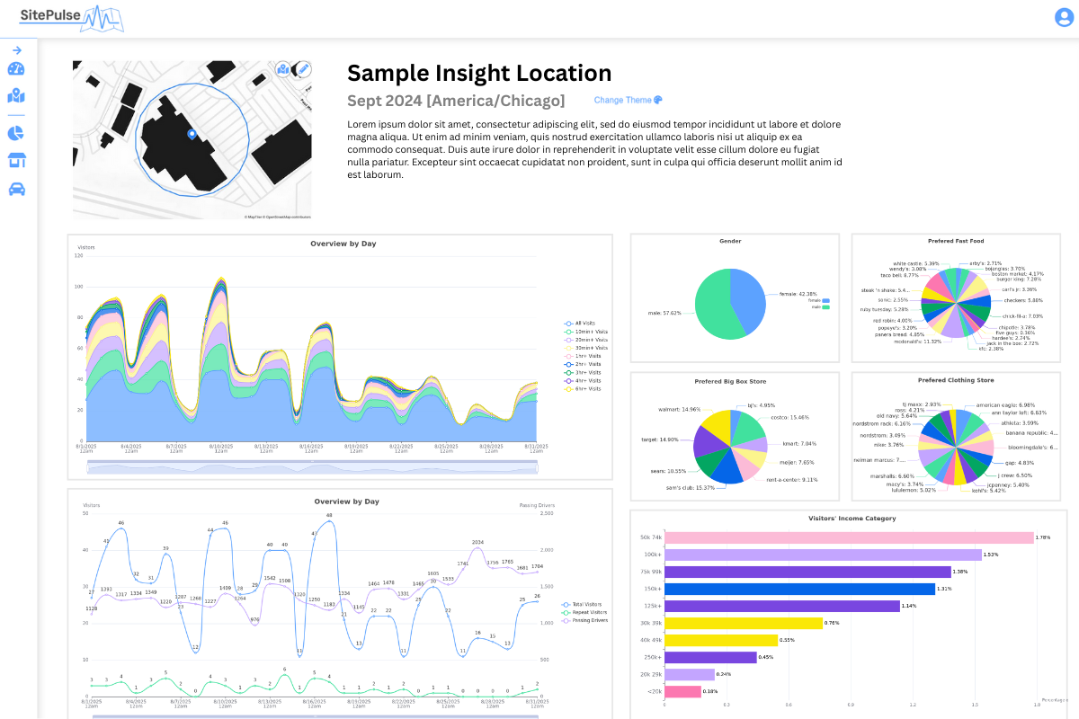
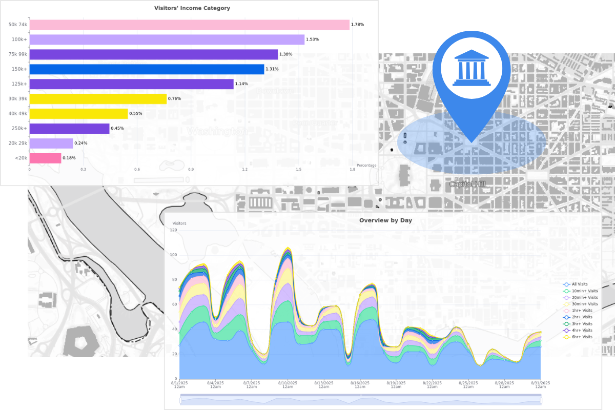
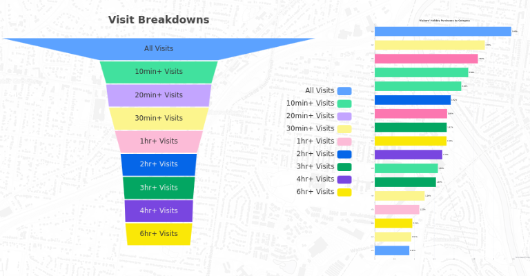
Clear, comprehensive insights at your custom locations without the need for analysts, data queries, or technical overhead.

Our in-house AI model turns complex data into clear visual insights while generating AI-ready prompts for customized consult using external tools.
No subscription. No waste. Our pricing is designed to give you full control over your analytics budget and minimize growth pain.
Prices vary based on length of roadway and number of visitor records. Here presents the pricing expectation for an example location with the following assumptions: